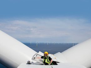
FOWIND commissions India’s first LiDAR for offshore wind assessment
The FOWIND Consortium will be commissioning India’s first offshore LiDAR off the coast of Gujarat, in the Gulf of Khambhat.
LiDAR, or Light Detection and Ranging, uses light from a pulsed laser to measure ranges. It has been commissioned for the National Institute of Wind Energy’s offshore platform.
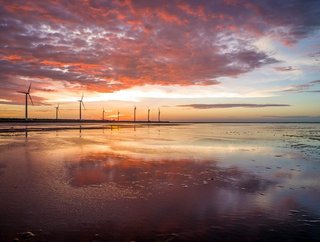
The data found will support India’s Ministry of New and Renewable Energy’s efforts towards exploring the full potential of offshore wind along coastline.
This is another contribution from the consortium, led by GWEC, towards ensuring that the offshore wind sector in India is supported by strong technical data.
SEE ALSO:
-
US and Denmark sign deal for offshore wind cooperation
-
Germans receive free power due to surplus energy
-
China to receive new 71.8m offshore turbine blade
- Read the latest issue of Energy Digital here
The consortium is made up of Global Wind Energy Council (GWEC), the Centre for Study of Science Technology and Policy (CSTEP), DNV-GL, Gujarat Power Corporation Ltd, the World Institute of Sustainable Energy, and “Knowledge Partner” the National Institute of Wind Energy (NEW).
“This is an important first step on the long road to establishing a vibrant and cost-effective offshore wind industry in India,” reported Steve Sawyer, GWEC Secretary General.
“I believe offshore wind will play an important role in India's clean energy future.”
“Providing the industry with preliminary measurement data to get a better understanding of the resource helps a great deal to make the stakeholders more comfortable since they can better estimate the risks involved,” said Mathias Steck, Executive Vice President & Regional Manager Asia Pacific, DNV GL - Energy.
“This will accelerate how offshore-wind in India will develop”.